
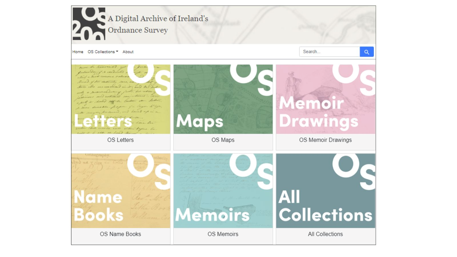
Nineteenth-century Ireland was the first country to be entirely and systematically mapped at a scale of six-inches-to-one-mile. The British military-led Ordinance Survey team traveled across pre-famine Ireland gathering a range of information, including geographical, archaeological and toponymical information including local customs, antiquities, and place names.
“These records capture the pre-famine landscape of localities across the island as they were in the 1820s and 1830s, including farming practices, language, folklore, trades, and religion, as well as details of the lives and activities of those employed by the OS in Ireland.
The cultural complexities of the OS in Ireland are recorded in a variety of source materials, not just maps. In various archives, museums and repositories across Ireland and Great Britain lie correspondence, statistical accounts, drawings and sketches, and comprehensive placenames, providing a pre-famine record of Ireland and its population. 1.”
The OS200 project is led jointly by Dr Catherine Porter at the University of Limerick (UL) and Professor Keith Lilley at Queen’s University Belfast (QUB), bringing together a cross-disciplinary team of geographers, historians, archivists, linguists, archaeologists, computer scientists, and digital specialists; their varied interests and specialisms helping inform the creation of a project database and online resource.
OS200 is a multi-project that aims to gather historic Ordnance Survey (OS) maps and texts, currently held in disparate archives, to form a single freely accessible online resource for academic and public use. 2
But why are these historic maps relevant? During the mapping of Ireland, the surveyors gathered a significant volume of other materials including letters, notebooks, memoir drawings, and place name books. The gathering of these resources in one single digital repository is opening up new thoughts and ideas of what the mapping process meant to Ireland at the time, its landscape and its society. Different iterations of this state ordnance survey can reveal a lot, not just from what is there, but what is not there.
I’ve always had a fascination with maps, and the process of mapping. The first ordnance map created was a townland survey, completed in 1846, for the purpose of levying local taxes based on land valuations by Lt-Col Thomas Colby, the Director General of Ordnance Survey in Britain. The team built a framework of trigonometrical stations upon which the mapping could be based. Using these trigonometrical stations and constructed bench marks, the country was mapped using triangulation. I have spotted some of these marks while out walking in the Kerry hills, still there after 200 years.
I have never used maps as part of my research, however, and while I considered them to be useful for historical work, I never realised the depth of the purpose of their existence, in particular in relation to military planning, before attending a fascinating conference on the project in Limerick University on the 22nd of Jan 2026. The discussions that took place at the conference opened up a world of thought for me, in relation to these early ordnance survey maps.
Excerpts taken from the OS200 Digital Archive of Ireland's Ordnance Survey website.
Attribution: OS200 and Royal Irish Academy.3
OS200: the world behind the maps conference took place on the 22nd of Jan 2026, in the Glucksman Library in the University of Limerick. Each of the speakers presented their nuanced research, telling the story of how they use these ordnance survey maps – how these maps can not only inform their work, but sometimes raise more questions than answers.
Professor David Fleming (UL) – Building Mitchelstown, 1779 – 1830
Professor Fleming spoke about his research on the history of Mitchelstown. During the first ordnance survey map, Mitchelstown, a town in north Cork, was a ‘new’ town. It was one of 750 Irish towns that was remodelled between 1690 and 1840, quite often at the behest of the reigning British landlord of the time.
The town was largely built over a period of fifty years between 1779 and 1830, at a time of significant national and local economic expansion, creating opportunities for investors and builders to develop and speculate. 4
Fleming spoke of how the first ordnance survey map was not the start of his research, but almost the end point, as the town was remodelled before the first map, so there is no detailed ordnance survey maps of the old town. In the absence of these maps, how do you do your research? The OS200 provides access to notes, sketches, diary entries, letters and more, all leading up to the making of the first map. Using these resources as well as parish records, newspaper articles and other secondary sources, Fleming was able to build up a picture of what the old Mitchelstown looked like. The town was probably moved and modelled for a number of reasons; because the landlord of the time, Earl of Kinston, wanted to build his new castle, one of the biggest neo-Gothic houses in Ireland, and needed extra land for his demesne, and possibly to modernise the town with better access and a larger market area. One thing Fleming noticed was the difference between the street names in the old town, obtained from parish records and the street names in the newly remodelled town, shown on the first maps; that gentrification of Irish street names was happening even in the C19th. One street originally called Bullock Lane in parish records, possibly changed to one of the Earl’s sons, George Street or James Street.
Dr. Niamh NicGhabhann Colemann (UL)- pre-famine church and chapel building
Dr. NicGhabhann Colemann’s work focuses on Roman Catholic architecture in Ireland between 1795 and 1935. She showcased, using photos and maps, a variety of churches and chapels in Ireland. Using different iterations of the ordnance survey maps, drawings and sketches, she is able to identify new builds, remodling and changing uses for religious architectural heritage. Also, the growth of Catholic chapels, which slowly became churches, (when allowed by the British coloniser). 5. 6.
Rebecca O’Regan (UL) – Female philanthropy in pre-famine Ireland: A case study of Adare, Co. Limerick
O’Regan is a PhD student at UL; she spoke of her research into female philanthropy, in particular, the family of the Earl of Dunraven. Valentine Richard Quin, first a Baron, then Viscount, then Earl was awarded the fertile lands, south of Limerick city, after the disastrous rebellion of the Earl of Desmond. His son married the Welsh heiress Caroline Wyndham (1790–1870) of Dunraven Castle, and it was her money and philanthropy that changed the architecture of Adare village in the C19th. As well as building a new manor house on the site of the original property, records show Caroline and Windham, together and separately, wrought improvements to the picturesque village. 7.
O’Regan’s talk pointed out the fact Caroline, in particular, was very active in providing philanthropic support for the Catholic and Protestant inhabitants of Adare and its surrounding areas, but due to the usual omitting of ‘women’s work’ from historical archives, she is rarely credited with her personal and financial efforts. It was interesting to see Adare village on the OS maps, and see what developments were funded by Caroline, including multi-denominational schools and a fever hospital.
Dr Joseph Curran (Maynooth University) – Charitable Institutions and the state in nineteenth century Ireland
Dr Curran regularly works with the original ordnance survey map, as well as subsequent editions, as he explained the role of charitable institutions and organisations in Dublin in C19th. Multiple purpose-built philanthropic buildings appear on the maps of Dublin, catering for a number of charity activities and ailments, for rich and poor alike. From fever hospitals, venereal disease hospitals, to ‘Houses of Industry’ where people were taken if found begging on the streets of Dublin. These impressive stone buildings can be seen on the maps with different accounts and annotations made by the surveyors, and some of the buildings change size and use in different map editions. The maps, however, don’t tell the story of the philanthropic control or state control, how well run or how badly run these ‘charitable’ institutions were. While some buildings, like the venereal disease hospital, were not marked, out of a prudishness perhaps. The maps serve as a geographic pinpoint in time, but were not necessarily correct. Some buildings could be listed as what the intended was, rather than the current use. Some buildings changed function or perhaps became gendered, from mixed patients to female or male only, depending on the delicate sensibilities of the rich sponsors and also the religion that was running them at the time.
Dr. Jay Roszman (UCC) – land, violence, and governance in C19th Ireland
In the reports, notebooks and diaries of the first ordnance surveyors, were descriptions of how the locals treated them. Mainly it seems to be with open minds and curiosity, but there were areas where there was tension, and the surveyors were not welcomed. Dr Jay Roszman explores the characteristics of agrarian violence in pre-Famine Ireland; the relationship between violence and British state policy immediately preceding the Famine. 8. ‘Agrarian’ in this instance is interpreted as ‘everyday’, and was logged by the British constabulary in Ireland as ‘outages’.
These ‘outage’ reports were sent back to Britain and created a picture of political unrest in the Irish society at the time. For example, was the drunk man who threw a rock through the barracks window acting out of drunkenness, or was there any political motive behind that act of violence. A hand written database monitoring the Irish ‘peasants’ unrest with both poverty, oppression and British military rule. (How Britain managed to retain its monarchy after the French Revolution has always an interesting question for me).
What Roszman’s research is almost throwing shade on the ‘scientific marvel’ of ordnance survey maps and bringing us map-dreamers crashing down to earth with the realization that the first complete ordnance survey maps of Ireland was a colonial project – testing out a system of information and control. The first surveyors were staffed by members of the British Army.
It definitely raises more questions about these maps than answers.
Thoughts:
Looking back at the naïve willingness of the majority of the Irish to help the surveyors because they were perhaps curious, they loved sharing local knowledge and stories. There was also employment opportunities for Irish people, as skilled or semi-skilled labourers, and clerks. Earning a few pennies by helping carry equipment, or other small ways, could have made a difference to the poverty stricken population.
The maps themselves don’t tell us about the decision making process, but some of the accompanying materials, newly digitized in this archive, letters, notebooks, the name-books do. Who locally, would have the authority to confirm local names, of course the local priest and/or school teachers. Another layer of control would be the estate managers, the land agents, the elite landlords, and ultimately, the British state.
How did the British state use these maps for colonialism? How did the ruling landlords use these maps alter their own lands? I mean, moving whole towns because you want to, is pretty colonial. Were the maps used to track outages and agrarian violence in Ireland? Accurately mapped outages would greatly help in planning military manoeuvres to suppress any potential uprising. Many locals were reluctant to help the British constabulary or give any information in relation to these outages, for many reasons, perhaps they didn’t want the British there, or they feared reprisals from their own community.
And we haven’t even started on the lack of female representation!
The layers of emotions on top of these static maps. More emotions than I had ever imagined. It’s why I love going to talks and conferences, so many ideas, and selfishly, learning about so many avenues for research I can go down as I dive into my PhD.
Or maybe a curse, as I’m easily distracted…
You can read a storymap about the creation of Historic Mapping here on the Tailte Eireann website
Notes:
- Ireland Mapped
- Ireland Mapped
- Collage of drawings taken from the Ordnance Survey Digital Archive, in the Memoirs section. Image 1 is a drawing that occurs within text, which is image 3. See Ordnance Survey Memoirs of Ireland, v.23, 1993, p.25. The middle image is a Section drawing of a precipice, with dimensions of rampart. The Drawing occurs in the body of the text. See Ordnance Survey Memoirs of Ireland, v.23, 1993, p.27. Attribution:OS200 and Royal Irish Academy
- Building Mitchelstown, Fleming, Four Courts Press, 2025
- The Development of Catholic Chapels in Ireland Prior to Catholic Emancipation, 1778–1829, NicGhabhann Coleman, N., Dec 2025, In: Architectural History: 68, p. 123-152 30 p.
- ‘colonizer‘ my words, not Dr. NicGhabhann Colemanns.
- O’Sullivan, E. (2017). Caroline, Countess of Dunraven. In: Ascendancy Women and Elementary Education in Ireland. Palgrave Macmillan, Cham.
- Outrage in the Age of Reform: Irish Agrarian Violence, Imperial Insecurity, and British Governing Policy, 1830–1845, Roszman, J, 2022, Cambridge University Press.

So, what do you think ?