:::: MENU ::::
Posts tagged with: archaeology

Agisoft PhotoScan

blog header, with images from Agisoft Photoscan

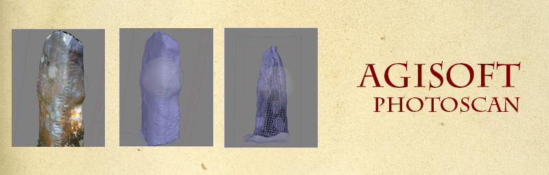
Agisoft PhotoScan (commonly known as PhotoScan) is a professional tool for a photogrammetry pipeline. It performs photogrammetric processing of digital images and generates 3D spatial data. Agisoft Photoscan is the dominant photogrammetric software on the market, being used by a range of professions, from archaeology, cartographers to creators of virtual worlds and game developers. Unlike Visual SfM, it contains a complete program to numerous specific tasks and different types of data, and, as a novice to photogrammetric software, was easily managed, with an efficient workflow system.

Continue Reading


Photogrammetry Timeline

blog header history of photogrammetry

As part of my research into digital tools and community participation, I have been looking at photogrammetry. In particular because I will be using it as part of the Ogham in 3D project. I realised how little I knew about the history of photogrammetry, and wanted to delve in deeper. As a visual learner, I find just reading articles and papers, still don’t quite connect the dots for me, and constantly find myself muddled with dates and names. So, I decided to create a visual (brief) timeline of the history of photogrammetry, to get a better idea of its origins, its uses, and significance today.

Continue Reading


css.php